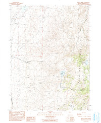
1990 Map of Knott Creek
USGS Topo · Published 1990About this map
The Pine Forest Range dominates the eastern landscape of this Humboldt County quadrangle, where the high desert terrain transitions into steep slopes and seasonal watercourses. Life in this arid region centers on scattered water sources such as Gridley Springs and the drainage of Craine Creek as it flows toward Alkali Flat. The infrastructure of the late twentieth century is visible in the engineered Knott Creek Channel and the Knott Creek Reservoir, which suggest a landscape managed for water storage and livestock.
Find a feature on this map
18 named features on this map. Tap any name to fly to it.
Don’t see what you’re looking for? This feature index may not catch every label — zoom into the map to look around manually.
Map Details
Editions of this 1990 Knott Creek Map
This is the sole edition of this map. No revisions or reprints were ever made.
Other maps of this area

1886 · Disaster
USGS Topo · 1:250,000

1893 · Disaster
USGS Topo · 1:250,000

1954 · Vya
USGS Topo · 1:250,000

1958 · Vya
USGS Topo · 1:250,000

1962 · Vya
USGS Topo · 1:250,000

1965 · Railroad Point
USGS Topo · 1:62,500

1965 · Idaho Canyon
USGS Topo · 1:62,500

1965 · Duffer Peak
USGS Topo · 1:62,500

1966 · Denio
USGS Topo · 1:62,500

1979 · Denio
USGS Topo · 1:100,000