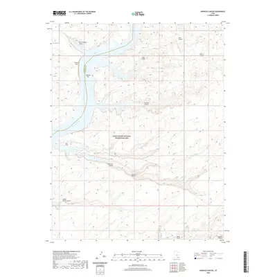
2020 Map of Knowles Canyon
USGS Topo · Published 2020About this map
The Colorado River and the expansive Lake Powell dominate this portion of the Glen Canyon National Recreation Area, where the waterway carves through the deep sandstone of the Red Rock Plateau. Along the shoreline, landforms like the Tapestry Wall and the Moki Stairs indicate the dramatic verticality of the canyon system. Historically significant sites such as Olympia Bar sit near the water's edge, reflecting the region's legacy of river-based exploration and alluvial mining.
Find a feature on this map
19 named features on this map. Tap any name to fly to it.
Don’t see what you’re looking for? This feature index may not catch every label — zoom into the map to look around manually.
Map Details
Editions of this 2020 Knowles Canyon Map
This is the sole edition of this map. No revisions or reprints were ever made.
Other maps of this area

1886 · Henry Mountains
USGS Topo · 1:250,000

1892 · Henry Mountains
USGS Topo · 1:250,000

1952 · Mancos Mesa
USGS Topo · 1:62,500

1953 · Mt Pennell 4 NE
USGS Topo · 1:24,000

1953 · Lake Canyon
USGS Topo · 1:62,500

1953 · Mt. Ellsworth
USGS Topo · 1:62,500

1954 · White Canyon 3 NW
USGS Topo · 1:24,000

1954 · White Canyon 3 SW
USGS Topo · 1:24,000

1954 · Clay Hills 2 NW
USGS Topo · 1:24,000
1954 · Clay Hills
USGS Topo · 1:62,500