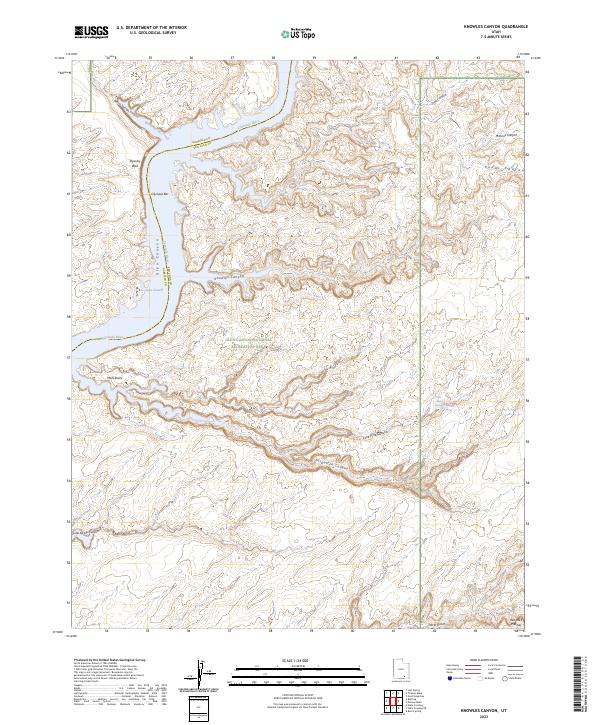
2023 Map of Knowles Canyon
USGS Topo · Published 2023About this map
Lake Powell and the Colorado River dominate this modern topographic record of the Glen Canyon National Recreation Area. The map documents a landscape of deep sandstone erosion and high canyon walls, including the sheer Tapestry Wall and the legendary Moki Stairs, where ancient inhabitants carved foot-and-hand holds into the rock. The branching waterways of Knowles Canyon, Forgotten Canyon, and Trail Canyon reveal the complex drainage patterns feeding into the reservoir.
Find a feature on this map
21 named features on this map. Tap any name to fly to it.
Don’t see what you’re looking for? This feature index may not catch every label — zoom into the map to look around manually.
Map Details
Editions of this 2023 Knowles Canyon Map
This is the sole edition of this map. No revisions or reprints were ever made.
Other maps of this area

1886 · Henry Mountains
USGS Topo · 1:250,000

1892 · Henry Mountains
USGS Topo · 1:250,000

1952 · Mancos Mesa
USGS Topo · 1:62,500

1953 · Mt Pennell 4 NE
USGS Topo · 1:24,000

1953 · Lake Canyon
USGS Topo · 1:62,500

1953 · Mt. Ellsworth
USGS Topo · 1:62,500

1954 · White Canyon 3 NW
USGS Topo · 1:24,000

1954 · White Canyon 3 SW
USGS Topo · 1:24,000

1954 · Clay Hills 2 NW
USGS Topo · 1:24,000
1954 · Clay Hills
USGS Topo · 1:62,500