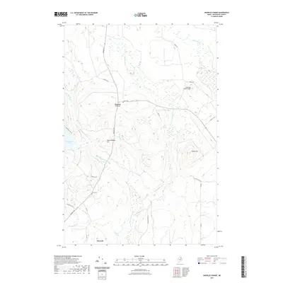
2021 Map of Knowles Corner
USGS Topo · Published 2021About this map
Knowles Corner serves as the central junction for this Aroostook County landscape, where Masardis Rd and state routes meet amidst a network of timberlands and waterways. The map highlights a rural Maine environment defined by the winding course of the W Br Mattawamkeag River, which flows past Mattawamkeag Hill toward the southern settlement of Batesville. Local genealogy is anchored by the Cooper Cem and Darling Cem, situated near family-named landmarks like Frost and Adams Ridge. To the east, Sholler Mtn rises above the drainage of E Hastings Brook, a tributary punctuated by both Upper Falls and Lower Falls. The western edge of the quadrangle is marked by the shoreline of Rockabema Lake, accessible via a logging road network that includes Rockabema Lake Rd and Lanebrook Rd.
Find a feature on this map
31 named features on this map. Tap any name to fly to it.
Don’t see what you’re looking for? This feature index may not catch every label — zoom into the map to look around manually.
Map Details
Editions of this 2021 Knowles Corner Map
This is the sole edition of this map. No revisions or reprints were ever made.
Other maps of this area

1935 · Howe Brook
USGS Topo · 1:48,000

1937 · Smyrna Mills
USGS Topo · 1:62,500

1939 · Howe Brook
USGS Topo · 1:62,500

1940 · Island Falls
USGS Topo · 1:62,500

1940 · Oxbow
USGS Topo · 1:62,500

1942 · Island Falls
USGS Topo · 1:62,500

1942 · Oxbow
USGS Topo · 1:62,500

1954 · Howe Brook
USGS Topo · 1:62,500

1954 · Presque Isle
USGS Topo · 1:250,000

1955 · Smyrna Mills
USGS Topo · 1:62,500