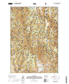
2020 Map of Knox Mountain
USGS Topo · Published 2020About this map
Malheur National Forest encompasses this high-elevation terrain along the border of Grant and Harney counties. Centered on the prominence of Knox Mtn, the landscape is defined by a dense network of seasonal drainages and named springs that supported early 20th-century livestock grazing. Points such as Miller and Jackson Spring and Moffitt Spring reflect the region's history of land use and pioneer water rights in a territory otherwise dominated by timber and steep canyons. To the north, Buttermilk Flat and Knox Meadow provide rare level ground amidst the ridges, while the southern portion of the map is shaped by the slopes of Antelope Mtn and the isolated Tuck Reservoir. This survey provides a clear view of the complex topography near Skookum Canyon and the headwaters of Crane Creek before the terrain descends toward the high desert basins.
Find a feature on this map
51 named features on this map. Tap any name to fly to it.
Don’t see what you’re looking for? This feature index may not catch every label — zoom into the map to look around manually.
Map Details
Editions of this 2020 Knox Mountain Map
This is the sole edition of this map. No revisions or reprints were ever made.
Other maps of this area

1908 · Ironside Mountain
USGS Topo · 1:125,000

1955 · Burns
USGS Topo · 1:250,000

1955 · Canyon City
USGS Topo · 1:250,000

1958 · Burns
USGS Topo · 1:250,000

1959 · Burns
USGS Topo · 1:250,000

1959 · Canyon City
USGS Topo · 1:250,000

1961 · Logan Valley
USGS Topo · 1:62,500

1968 · Drewsey
USGS Topo · 1:62,500

1968 · Van
USGS Topo · 1:62,500

1970 · Flag Prairie
USGS Topo · 1:62,500