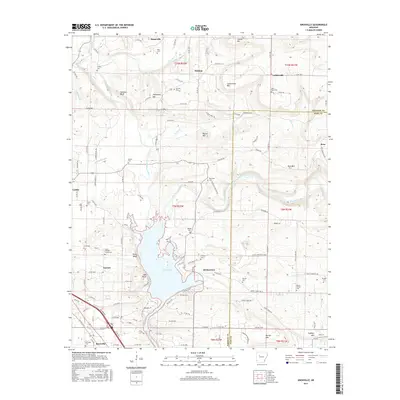
2017 Map of Knoxville
USGS Topo · Published 2017About this map
Lake Dardanelle dominates the southern landscape of this Arkansas survey, where the waters of Big Piney Creek flow south to meet the reservoir. The terrain is defined by a series of prominent elevations and bluffs, including Jackson Bluff, Lutherville Mtn, and Ross Mtn, which separate the various creek valleys. This area at the border of Johnson and Pope counties shows a well-established network of rural settlements and family landmarks. From the northern reach of Hagarville down through Hickeytown and Knoxville, the map reveals a high density of small cemeteries such as Cazort Cem, Maddin Cem, and the Lewis Johnson Family Cem. These sites, along with Saint Pauls Cem near Lutherville, suggest a deeply rooted residential history tied to the land between Minnow Creek and the river valley.
Find a feature on this map
135 named features on this map. Tap any name to fly to it.
Don’t see what you’re looking for? This feature index may not catch every label — zoom into the map to look around manually.
Map Details
Editions of this 2017 Knoxville Map
This is the sole edition of this map. No revisions or reprints were ever made.
Other maps of this area

1888 · Dardanelle #2
USGS Topo · 1:62,500

1888 · Dardanelle #1
USGS Topo · 1:62,500

1889 · Treat
USGS Topo · 1:62,500

1889 · Ozone
USGS Topo · 1:62,500

1890 · Dardanelle
USGS Topo · 1:125,000

1932 · Treat
USGS Topo · 1:62,500

1934 · Treat
USGS Topo · 1:62,500

1934 · Ozone
USGS Topo · 1:62,500

1936 · Ozone
USGS Topo · 1:62,500

1956 · Russellville
USGS Topo · 1:250,000