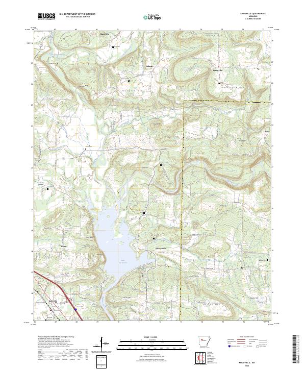
2024 Map of Knoxville
USGS Topo · Published 2024About this map
Lake Dardanelle dominates the southern portion of this landscape, its expansive waters meeting the dramatic bluffs of the Arkansas River valley. The confluence of Big Piney Creek and Little Piney Creek defines the local drainage, creating a network of ridges and hollows that historically dictated settlement patterns. Small communities like Hagarville and Lutherville serve as anchors in this upland terrain, which is marked by numerous family and community landmarks such as the Saint Pauls Cem and Cazort Cem.
Find a feature on this map
75 named features on this map. Tap any name to fly to it.
Don’t see what you’re looking for? This feature index may not catch every label — zoom into the map to look around manually.
Map Details
Editions of this 2024 Knoxville Map
This is the sole edition of this map. No revisions or reprints were ever made.
Other maps of this area

1888 · Dardanelle #2
USGS Topo · 1:62,500

1888 · Dardanelle #1
USGS Topo · 1:62,500

1889 · Treat
USGS Topo · 1:62,500

1889 · Ozone
USGS Topo · 1:62,500

1890 · Dardanelle
USGS Topo · 1:125,000

1932 · Treat
USGS Topo · 1:62,500

1934 · Treat
USGS Topo · 1:62,500

1934 · Ozone
USGS Topo · 1:62,500

1936 · Ozone
USGS Topo · 1:62,500

1956 · Russellville
USGS Topo · 1:250,000