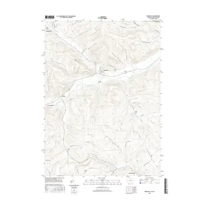
2016 Map of Knoxville
USGS Topo · Published 2016About this map
Knoxville serves as the central hub of this northern Pennsylvania landscape, situated where Troups Creek meets the Cowanesque River. The map reveals a deeply etched topography of north-south drainage valleys including Abbott Hollow, Wheaton Hollow, and Moffit Hollow, which define the agricultural and timbered uplands above the river flats. The density of genealogical markers is particularly high, featuring numerous small family and community burial grounds such as the Austinburg Pioneer Cem, the Joseph Howland Cem, and the Site of the Free Church Cem.
Find a feature on this map
64 named features on this map. Tap any name to fly to it.
Don’t see what you’re looking for? This feature index may not catch every label — zoom into the map to look around manually.
Map Details
Editions of this 2016 Knoxville Map
This is the sole edition of this map. No revisions or reprints were ever made.
Other maps of this area

1899 · Gaines
USGS Topo · 1:62,500

1900 · Gaines
USGS Topo · 1:62,500

1900 · Elkland
USGS Topo · 1:62,500

1924 · Woodhull
USGS Topo · 1:48,000

1926 · Woodhull
USGS Topo · 1:62,500

1926 · Greenwood
USGS Topo · 1:62,500

1944 · Woodhull
USGS Topo · 1:62,500

1950 · Elmira
USGS Topo · 1:250,000

1953 · Woodhull
USGS Topo · 1:24,000
1953 · Borden
USGS Topo · 1:24,000