2023 Map of Knoxville
USGS Topo · Published 2023About this map
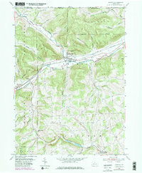
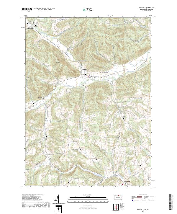
Knoxville and the surrounding river valley landscape are meticulously detailed in this recent topographical survey. The town serves as a focal point along the Cowanesque River, where the valley floor meets the rising terrain of Fork Hill and Rose Valley. To the south, the valley of Crooked Creek provides a lower elevation route through the hills near Little Marsh. The map is particularly notable for its density of local genealogical landmarks, including historic burial sites such as the Quaker Burying Ground and Riverside Cem. In the rural uplands, family-named landmarks like the Joseph Howland Cem and Old Shellman Cem provide a clear connection to the agricultural history of this corner of Tioga County. Modern infrastructure like the Knoxville Reservoir and a network of hill roads like Dingman Rd and Merrick Hill Rd illustrate how the community interfaces with the narrow hollows and steep ridges that define the regional geography.
Find a feature on this map
70 named features on this map. Tap any name to fly to it.
Don’t see what you’re looking for? This feature index may not catch every label — zoom into the map to look around manually.
Map Details
Editions of this 2023 Knoxville Map
This is the sole edition of this map. No revisions or reprints were ever made.