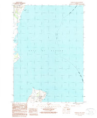
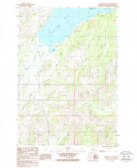
1987 Map of Kodiak B-1 NW
USGS Topo · Published 1988About this map
Ugak Island sits prominently at the southern edge of this coastal survey, defined by its steep terrain and surrounding Rocks. To the north, the coastline of Kodiak Island transitions from the protected waters of Barry Lagoon to the exposed headland of Narrow Cape. The landscape in the late 1980s reveals a mix of natural maritime features and limited human activity, including a Gravel Pit located near the northern shoreline. This area within the Kodiak Island Borough is characterized by its dramatic interface with the Gulf of Alaska, where offshore hazards like Lone Rocks underscore the maritime character of the region. The map provides a detailed look at the island's coastal geography before further modern development, documenting the precise shoreline and topographic contours as they existed during the field checks of the early 1980s.
Find a feature on this map
9 named features on this map. Tap any name to fly to it.
Don’t see what you’re looking for? This feature index may not catch every label — zoom into the map to look around manually.
Map Details
Editions of this 1987 Kodiak B-1 NW Map
This is the sole edition of this map. No revisions or reprints were ever made.
Other maps of this area

1949 · Kodiak C-2
USGS Topo · 1:63,360

1949 · Kodiak B-1 and B-2
USGS Topo · 1:63,360

1949 · Kodiak C-1
USGS Topo · 1:63,360

1951 · Kodiak B-1 and B-2
USGS Topo · 1:63,360

1951 · Kodiak C-1
USGS Topo · 1:63,360

1952 · Kodiak
USGS Topo · 1:250,000
1987 · Kodiak C-1 SW
USGS Topo · 1:25,000
1987 · Kodiak B-2 NE
USGS Topo · 1:25,000
1987 · Kodiak C-1 SE
USGS Topo · 1:25,000
1987 · Kodiak C-2 SE
USGS Topo · 1:25,000