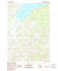
1987 Map of Kodiak C-2 SE
USGS Topo · Published 1988About this map
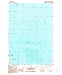
Kalsin Bay dominates this coastal survey, where the saltwater meet the drainage basins of the Olds River and Kalsin Creek. In the late 1980s, the coastal infrastructure relied on the intersection of the Kodiak Island Highway, Pasagshak Point Road, and Chiniak Road, which provided the primary overland access to the rugged interior. The landscape rises sharply from the shoreline and Brookers Lagoon toward the peaks of the Marin Range in the southeast. Evidence of local industry and monitoring is found in a Gravel Pit near Kalsin Pond and a Gaging Station positioned along the lower reaches of the local waterways. The map details a complex network of coastal creeks, including Frank Creek, Myrtle Creek, and Zener Creek, illustrating the heavy freshwater runoff typical of the island's topography during this era.
Find a feature on this map
22 named features on this map. Tap any name to fly to it.
Don’t see what you’re looking for? This feature index may not catch every label — zoom into the map to look around manually.
Map Details
Editions of this 1987 Kodiak C-2 SE Map
This is the sole edition of this map. No revisions or reprints were ever made.
Other maps of this area

1949 · Kodiak C-2
USGS Topo · 1:63,360

1949 · Kodiak B-1 and B-2
USGS Topo · 1:63,360

1949 · Kodiak C-1
USGS Topo · 1:63,360

1951 · Kodiak B-1 and B-2
USGS Topo · 1:63,360

1951 · Kodiak C-1
USGS Topo · 1:63,360

1952 · Kodiak
USGS Topo · 1:250,000
1987 · Kodiak C-1 SW
USGS Topo · 1:25,000
1987 · Kodiak C-2 NW
USGS Topo · 1:25,000
1987 · Kodiak C-2 NE
USGS Topo · 1:25,000
1987 · Kodiak C-1 NW
USGS Topo · 1:25,000