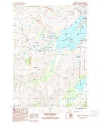
1987 Map of Kodiak C-2 NW
USGS Topo · Published 1988About this map
Womens Bay and the surrounding coastline of Kodiak Island are the focus of this 1980s-era topographic study, dominated by the extensive US Coast Guard Reservation. The landscape is characterized by a mix of rugged peaks and low-lying alluvial areas, most notably the Bell Flats where Russian Creek and Womens Creek reach the sea. The map documents significant military and civil infrastructure, including the Kodiak Island Highway skirting the coast and the Nyman Peninsula with its various docks and tanks. Inland, the terrain rises sharply toward Erskine Mountain and Old Womens Mountain. A cluster of small lakes, such as Lake Orbin and Lake Caroline, are tucked into the drainages north of the Eddys Range, providing a detailed look at the island's hydrology before later development. The small settlement of Panamaroff and a Fairground near the coast mark the few non-military cultural sites on this part of the island.
Find a feature on this map
39 named features on this map. Tap any name to fly to it.
Don’t see what you’re looking for? This feature index may not catch every label — zoom into the map to look around manually.
Map Details
Editions of this 1987 Kodiak C-2 NW Map
2 editions found
Other maps of this area

1947 · Kodiak D-3
USGS Topo · 1:63,360

1949 · Kodiak C-2
USGS Topo · 1:63,360

1949 · Kodiak D-2
USGS Topo · 1:63,360

1949 · Kodiak D-3
USGS Topo · 1:63,360

1950 · Kodiak D-3
USGS Topo · 1:63,360

1951 · Kodiak D-2
USGS Topo · 1:63,360

1952 · Kodiak
USGS Topo · 1:250,000

1952 · Kodiak C-3
USGS Topo · 1:63,360

1954 · Kodiak C-3
USGS Topo · 1:63,360
1987 · Kodiak C-2 NE
USGS Topo · 1:25,000