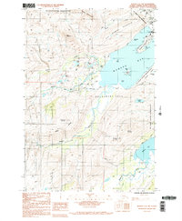
1987 Map of Kodiak C-2 NW
USGS Topo · Published 1988About this map
The US Coast Guard Reservation dominates the northeastern shoreline of this late 20th-century survey, securing the strategic deep-water access points around Womens Bay. The landscape transitions from the coastal infrastructure of the Nyman Peninsula to the dramatic elevations of the Eddys Range and Kashevaroff Mountain. This area shows a complex intersection of federal maritime land use and high-latitude wilderness, where the American River and Russian Creek drain into the sound. Notable for local historians are the numerous family-named landmarks and water bodies, such as Panamaroff Creek and Beaver Lake, which suggest a long history of local navigation and land usage. The map also delineates US Survey 2539, providing a record of cadastral boundaries amidst the rugged terrain of Old Womens Mountain and Zaimka Ridge.
Find a feature on this map
37 named features on this map. Tap any name to fly to it.
Don’t see what you’re looking for? This feature index may not catch every label — zoom into the map to look around manually.
Map Details
Editions of this 1987 Kodiak C-2 NW Map
2 editions found
Other maps of this area

1947 · Kodiak D-3
USGS Topo · 1:63,360

1949 · Kodiak C-2
USGS Topo · 1:63,360

1949 · Kodiak D-2
USGS Topo · 1:63,360

1949 · Kodiak D-3
USGS Topo · 1:63,360

1950 · Kodiak D-3
USGS Topo · 1:63,360

1951 · Kodiak D-2
USGS Topo · 1:63,360

1952 · Kodiak
USGS Topo · 1:250,000

1952 · Kodiak C-3
USGS Topo · 1:63,360

1954 · Kodiak C-3
USGS Topo · 1:63,360
1987 · Kodiak C-2 NW
USGS Topo · 1:25,000