
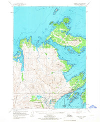
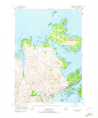
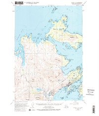
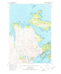
1949 Map of Kodiak D-2
USGS Topo · Published 1958About this map
Kodiak Island's northeastern coastline and neighboring Spruce Island appear here during a period of significant post-war military and maritime activity. The town of Kodiak serves as a hub of coastal life, situated near the sprawling U S Naval Reservation and the waters of St Paul Harbor. To the north, the settlement of Uzinki, also identified as Ouzinkie PO, anchors the community on Spruce Island, nestled below the heights of Mount Herman. The landscape is defined by its complex shoreline, where Narrow Strait separates the islands, and notable navigation aids like Three Brothers Light and Otmeloi Light guide vessels. Inland, the terrain rises sharply into named peaks such as Monashka Mountain, the Devils Prongs, and Pyramid Mountain, while numerous freshwater bodies like Buskin Lake and Lake Louise dot the coastal lowlands.
Find a feature on this map
79 named features on this map. Tap any name to fly to it.
Don’t see what you’re looking for? This feature index may not catch every label — zoom into the map to look around manually.
Map Details
Editions of this 1949 Kodiak D-2 Map
5 editions found
Other maps of this area

1947 · Kodiak D-3
USGS Topo · 1:63,360

1949 · Kodiak C-2
USGS Topo · 1:63,360

1949 · Kodiak D-3
USGS Topo · 1:63,360

1949 · Kodiak C-1
USGS Topo · 1:63,360

1949 · Kodiak D-1
USGS Topo · 1:63,360

1950 · Kodiak D-3
USGS Topo · 1:63,360

1951 · Kodiak D-1
USGS Topo · 1:63,360

1951 · Kodiak D-2
USGS Topo · 1:63,360

1951 · Kodiak C-1
USGS Topo · 1:63,360

1952 · Kodiak
USGS Topo · 1:250,000