
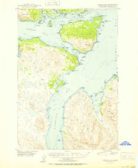
1950 Map of Kodiak D-3
USGS Topo · Published 1950About this map
The maritime landscape of the Kodiak Island archipelago is defined by a complex network of waterways and mountainous islands as it appeared shortly after World War II. Centered on the intersection of Kupreanof Strait and Afognak Strait, the geography is shaped by deep maritime passages like Whale Passage and Raspberry Strait. Inland, the high peaks of Sharatin Mountain and Elbow Mtn rise sharply above Sharatin Bay. Portions of the Chugach National Forest extend across the northern reaches of Afognak Island and Raspberry Island. This topography reflects the maritime-focused settlement patterns of the era, where coastal landmarks like Barabara Cove and Settler Cove served as vital reference points for local navigation and coastal activity before modern infrastructure altered the coastline.
Find a feature on this map
56 named features on this map. Tap any name to fly to it.
Don’t see what you’re looking for? This feature index may not catch every label — zoom into the map to look around manually.
Map Details
Editions of this 1950 Kodiak D-3 Map
2 editions found
Other maps of this area

1947 · Kodiak D-3
USGS Topo · 1:63,360

1949 · Kodiak C-2
USGS Topo · 1:63,360

1949 · Kodiak D-2
USGS Topo · 1:63,360

1949 · Kodiak D-3
USGS Topo · 1:63,360

1951 · Kodiak D-2
USGS Topo · 1:63,360

1952 · Kodiak
USGS Topo · 1:250,000

1952 · Afognak
USGS Topo · 1:250,000

1952 · Kodiak C-3
USGS Topo · 1:63,360

1952 · Afognak A-4
USGS Topo · 1:63,360

1952 · Kodiak C-4
USGS Topo · 1:63,360