
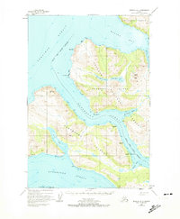
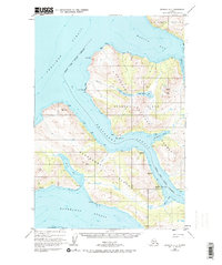
1952 Map of Afognak A-4
USGS Topo · Published 1965About this map
Afognak Island and Raspberry Island are separated by the narrow, protected corridor of Raspberry Strait in this early 1950s survey. The map documents a maritime landscape defined by isolated outposts and the fishing industry of the era, centered on locations like Port Wakefield and the abandoned site of Port Vita (Aband). A Seaplane Base on the eastern shore of Raspberry Island highlights the critical role of aviation for transportation in this remote coastal environment. Within the Chugach National Forest, the terrain rises to summits like Cloud Peak, while drainages like Malina Creek feed from Upper Malina Lake and Lower Malina Lake into the deep waters of Malina Bay. The intricate coastline is further marked by Onion Bay and Selief Bay, providing insight into the natural harbors that shaped human activity on the islands.
Find a feature on this map
28 named features on this map. Tap any name to fly to it.
Don’t see what you’re looking for? This feature index may not catch every label — zoom into the map to look around manually.
Map Details
Editions of this 1952 Afognak A-4 Map
3 editions found
Other maps of this area

1947 · Kodiak D-3
USGS Topo · 1:63,360

1949 · Kodiak D-3
USGS Topo · 1:63,360

1950 · Kodiak D-3
USGS Topo · 1:63,360

1952 · Kodiak
USGS Topo · 1:250,000

1952 · Afognak
USGS Topo · 1:250,000

1952 · Kodiak D-5
USGS Topo · 1:63,360

1952 · Afognak A-3
USGS Topo · 1:63,360
1952 · Afognak A-5
USGS Topo · 1:63,360

1952 · Kodiak D-4
USGS Topo · 1:63,360
1952 · Afognak B-4
USGS Topo · 1:63,360