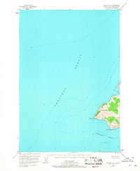
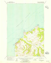
1952 Map of Afognak A-5
USGS Topo · Published 1968About this map
Raspberry Island marks the eastern boundary of this mid-century survey, where the island's steep, mountainous terrain drops sharply into the surrounding waters. Based on aerial photography and hydrographic data from 1952, the map illustrates the maritime landscape at the confluence of the Shelikof Strait and Kupreanof Strait. The western coastline of the island is clearly defined by prominent features such as Raspberry Cape and Malina Point, where the Malina 2 Light serves as a critical aid for navigating the approach to Driver Bay. This sheet reveals the geological character of the Kodiak Island Borough before more modern infrastructure, focusing on the natural contours and bathymetric depths that dictated the movement of vessels through these Alaskan channels.
Find a feature on this map
7 named features on this map. Tap any name to fly to it.
Don’t see what you’re looking for? This feature index may not catch every label — zoom into the map to look around manually.
Map Details
Editions of this 1952 Afognak A-5 Map
2 editions found
Other maps of this area

1951 · Kodiak D-6
USGS Topo · 1:63,360

1952 · Kodiak
USGS Topo · 1:250,000

1952 · Afognak
USGS Topo · 1:250,000

1952 · Afognak A-4
USGS Topo · 1:63,360

1952 · Kodiak D-5
USGS Topo · 1:63,360

1952 · Kodiak D-4
USGS Topo · 1:63,360
1952 · Afognak B-4
USGS Topo · 1:63,360

1953 · Afognak A-4
USGS Topo · 1:63,360
1953 · Afognak A-5
USGS Topo · 1:63,360
1954 · Kodiak D-6
USGS Topo · 1:63,360