
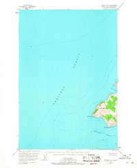
1953 Map of Afognak A-4
USGS Topo · Published 1955About this map
Afognak Island and its neighbor, Raspberry Island, dominate this early 1950s coastal survey, separated by the winding channel of Raspberry Strait. The landscape is defined by the sharp elevations of Chugach and the 2,385-foot Cloud Peak, illustrating the maritime-dependent settlement pattern of the era. On the eastern shore of Raspberry Island, the coastal outposts of Port Vita and Port Wakefield stand as primary points of human activity, likely serving the local fishing industry. The interior is largely untouched, characterized by the Upper Malina Lake and Lower Malina Lake systems feeding into Malina Bay. Navigational markers like the Light near Dolphin Pt and various tidal benchmarks reflect the critical nature of these waterways for transport between She likof Strait and Kupreanof Strait.
Find a feature on this map
38 named features on this map. Tap any name to fly to it.
Don’t see what you’re looking for? This feature index may not catch every label — zoom into the map to look around manually.
Map Details
Editions of this 1953 Afognak A-4 Map
This is the sole edition of this map. No revisions or reprints were ever made.
Other maps of this area

1947 · Kodiak D-3
USGS Topo · 1:63,360

1949 · Kodiak D-3
USGS Topo · 1:63,360

1950 · Kodiak D-3
USGS Topo · 1:63,360

1952 · Kodiak
USGS Topo · 1:250,000

1952 · Afognak
USGS Topo · 1:250,000

1952 · Afognak A-4
USGS Topo · 1:63,360

1952 · Kodiak D-5
USGS Topo · 1:63,360

1952 · Afognak A-3
USGS Topo · 1:63,360
1952 · Afognak A-5
USGS Topo · 1:63,360

1952 · Kodiak D-4
USGS Topo · 1:63,360