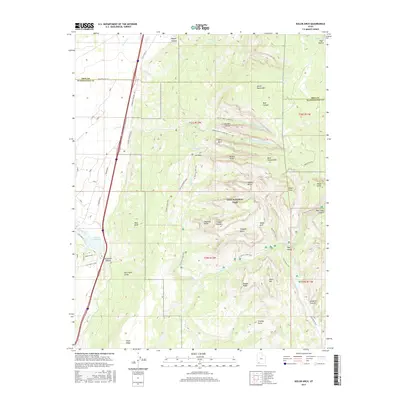
2017 Map of Kolob Arch
USGS Topo · Published 2017About this map
Zion National Park dominates this portion of Southern Utah, showcasing a complex network of high desert peaks and deep canyons. The map centers on the namesake Kolob Arch, one of the world's largest natural arches, located deep within the wilderness north of Gregory Butte. Access to this remote backcountry is traced through several significant routes, including the Timber Creek Trail and the La Verkin Creek Trail, which originate near Lee Pass along the Kolob Canyons Road. To the west, the geological transition is marked by the dramatic Hurricane Cliffs and the dark volcanic basalt of Black Ridge. The presence of Ash Cr Reservoir and the parallel tracks of Old US Hwy 91 and modern Interstate 15 highlight the narrow corridor of human infrastructure that bypasses the massive monoliths like Horse Ranch Mtn and Timber Top Mtn.
Find a feature on this map
60 named features on this map. Tap any name to fly to it.
Don’t see what you’re looking for? This feature index may not catch every label — zoom into the map to look around manually.
Map Details
Editions of this 2017 Kolob Arch Map
This is the sole edition of this map. No revisions or reprints were ever made.
Other maps of this area

1885 · St. George
USGS Topo · 1:250,000

1891 · St. George
USGS Topo · 1:250,000

1950 · Kanarraville
USGS Topo · 1:24,000

1950 · Iron Mountain
USGS Topo · 1:62,500

1950 · Cedar City
USGS Topo · 1:62,500

1950 · Cedar Mountain
USGS Topo · 1:24,000

1950 · Stoddard Mtn
USGS Topo · 1:24,000

1951 · Kanarraville
USGS Topo · 1:24,000

1951 · Stoddard Mtn
USGS Topo · 1:24,000

1952 · Cedar Mountain
USGS Topo · 1:24,000