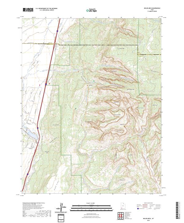
2023 Map of Kolob Arch
USGS Topo · Published 2023About this map
Zion National Park and its surrounding protected lands dominate this modern study of the high plateau and canyon country near the Iron and Washington County line. The map highlights the intersection of significant desert drainages, including the South Fork Taylor Creek and La Verkin Creek, which carve through prominent formations like Nagunt Mesa and Timber Top Mtn. A focal point of the area is the Kolob Arch, accessible via the Kolob Arch Trl. The geography is defined by the massive vertical relief of the Hurricane Cliffs and Black Ridge, where the high desert meets the canyon systems. Human transit is confined largely to the western edge along Old US Hwy 91 and the Kolob Canyons Road, which provides access to the trailhead at Lee Pass.
Find a feature on this map
60 named features on this map. Tap any name to fly to it.
Don’t see what you’re looking for? This feature index may not catch every label — zoom into the map to look around manually.
Map Details
Editions of this 2023 Kolob Arch Map
This is the sole edition of this map. No revisions or reprints were ever made.
Other maps of this area

1885 · St. George
USGS Topo · 1:250,000

1891 · St. George
USGS Topo · 1:250,000

1950 · Kanarraville
USGS Topo · 1:24,000

1950 · Iron Mountain
USGS Topo · 1:62,500

1950 · Cedar City
USGS Topo · 1:62,500

1950 · Cedar Mountain
USGS Topo · 1:24,000

1950 · Stoddard Mtn
USGS Topo · 1:24,000

1951 · Kanarraville
USGS Topo · 1:24,000

1951 · Stoddard Mtn
USGS Topo · 1:24,000

1952 · Cedar Mountain
USGS Topo · 1:24,000