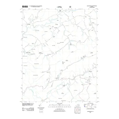
2011 Map of Konnarock
USGS Topo · Published 2011About this map
Konnarock serves as a primary settlement in this corner of southwest Virginia, where the valley terrain meets the high ridges of the Iron Mountains. The landscape is defined by the winding course of the South Fork Holston River and Whitetop Laurel Creek, which create natural corridors for transportation and early settlement. These waterways are flanked by numerous family-named hollows and ridges, such as Joe Doss Hollow and Chestnut Ridge.
Find a feature on this map
103 named features on this map. Tap any name to fly to it.
Don’t see what you’re looking for? This feature index may not catch every label — zoom into the map to look around manually.
Map Details
Editions of this 2011 Konnarock Map
This is the sole edition of this map. No revisions or reprints were ever made.
Other maps of this area

1891 · Abingdon
USGS Topo · 1:125,000

1894 · Abingdon
USGS Topo · 1:125,000

1909 · Abingdon
USGS Topo · 1:96,000

1911 · Abingdon
USGS Topo · 1:125,000

1935 · Konnarock
USGS Topo · 1:24,000

1935 · Chilhowie
USGS Topo · 1:24,000

1935 · Grayson
USGS Topo · 1:24,000

1935 · Park
USGS Topo · 1:24,000

1935 · Mount Rogers
USGS Topo · 1:48,000
1935 · Laurel Bloomery
USGS Topo · 1:24,000