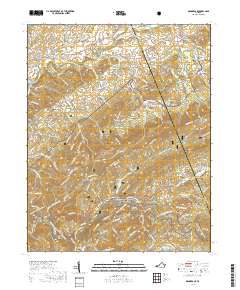
2019 Map of Konnarock
USGS Topo · Published 2019About this map
Jefferson National Forest dominates the mountain landscape of Southwest Virginia, where the Appalachian National Scenic Trail winds through high ridges including Iron Mountain and Straight Mountain. This 2019 survey documents the enduring settlements of Konnarock and Taylors Valley, areas historically tied to the timber and rail economy of the Blue Ridge. The map shows the winding course of the South-Fork Holston River in the north near Loves Mill and Friendship, while the southern portion is defined by the sharp descent of Whitetop Laurel Cr toward Creek Junction. Numerous family-named burial sites like Macedonia Cem and Byars Cem are situated throughout the valleys, providing a clear record of local genealogy. Interesting terrain features such as Horseshoe Bend, Frank Coe Hollow, and Summit Cut further illustrate the complex topography of this border region between Washington and Smyth Counties.
Find a feature on this map
150 named features on this map. Tap any name to fly to it.
Don’t see what you’re looking for? This feature index may not catch every label — zoom into the map to look around manually.
Map Details
Editions of this 2019 Konnarock Map
This is the sole edition of this map. No revisions or reprints were ever made.
Other maps of this area

1891 · Abingdon
USGS Topo · 1:125,000

1894 · Abingdon
USGS Topo · 1:125,000

1909 · Abingdon
USGS Topo · 1:96,000

1911 · Abingdon
USGS Topo · 1:125,000

1935 · Konnarock
USGS Topo · 1:24,000

1935 · Chilhowie
USGS Topo · 1:24,000

1935 · Grayson
USGS Topo · 1:24,000

1935 · Park
USGS Topo · 1:24,000

1935 · Mount Rogers
USGS Topo · 1:48,000
1935 · Laurel Bloomery
USGS Topo · 1:24,000