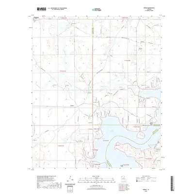
2020 Map of Koran
USGS Topo · Published 2020About this map
Koran serves as a central settlement in this portion of Bossier Parish, where the geography is defined by the winding course of Clarke Bayou and the expansive waters of Lake Bistineau. The area is notably dense with historical markers, particularly small community burial grounds and houses of worship. Genealogists will find a wealth of records through the distribution of sites like Bethlehem Church Cem, Camp Zion Cem, and Saint Pauls Cem. These landmarks, often situated along rural routes like Koran Doyline Rd and Camp Joy Rd, reflect the long-standing family foundations of the region. Along the shoreline, landforms such as Fairview Point and Adam Point jut into the lake, while Plum Orchard Island and Peggy Island sit within the channel, illustrating the complex transition from parish lowlands to the lake’s edge near Pine Bluff.
Find a feature on this map
108 named features on this map. Tap any name to fly to it.
Don’t see what you’re looking for? This feature index may not catch every label — zoom into the map to look around manually.
Map Details
Editions of this 2020 Koran Map
This is the sole edition of this map. No revisions or reprints were ever made.
Other maps of this area

1932 · Bossier SE
USGS Topo · 1:31,680

1938 · Arnsberg
USGS Topo · 1:31,680

1941 · Bossier Point
USGS Topo · 1:31,680

1947 · Ringgold
USGS Topo · 1:62,500

1947 · Minden
USGS Topo · 1:62,500

1948 · Bossier City
USGS Topo · 1:62,500

1948 · Caspiana
USGS Topo · 1:62,500

1949 · Minden
USGS Topo · 1:62,500

1955 · Shreveport
USGS Topo · 1:250,000

1955 · Caspiana
USGS Topo · 1:62,500