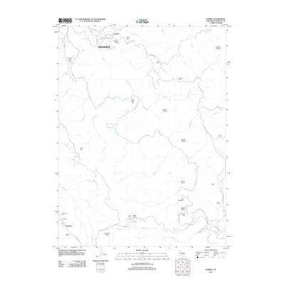
2012 Map of Korbel
USGS Topo · Published 2012About this map
Korbel and the Riverside area sit at the heart of this landscape, where the N Fork Mad River meets the main stem of the Mad River. The map documents a rugged Humboldt County interior defined by timber-era settlements and numerous family-held properties such as the Angel Ranch, Anderson Ranch, and Allard Ranch. The winding course of Maple Cr and Canon Cr carve through high ground punctuated by distinctive landmarks like the Indian Arrow Tree and the open expanses of Garner Prairie and Spring Prairie.
Find a feature on this map
60 named features on this map. Tap any name to fly to it.
Don’t see what you’re looking for? This feature index may not catch every label — zoom into the map to look around manually.
Map Details
Editions of this 2012 Korbel Map
This is the sole edition of this map. No revisions or reprints were ever made.
Other maps of this area

1922 · Eureka
USGS Topo · 1:62,500

1922 · Korbel
USGS Topo · 1:62,500

1922 · Kneeland
USGS Topo · 1:62,500

1933 · Eureka
USGS Topo · 1:48,000

1942 · Eureka
USGS Topo · 1:62,500

1944 · Fortuna
USGS Topo · 1:62,500

1945 · Blue Lake
USGS Topo · 1:62,500

1949 · Eureka
USGS Topo · 1:250,000

1950 · Iaqua Buttes
USGS Topo · 1:62,500

1951 · Eureka
USGS Topo · 1:62,500