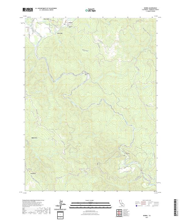
2021 Map of Korbel
USGS Topo · Published 2021About this map
The timber and river country of Humboldt County is documented in this 2021 study, highlighting the intersection of industrial transport and complex topography. The Mad River and its North Fork carve through the landscape, defining the character of small settlements like Korbel and Riverside at the northern edge. Significant terrain features such as Fickle Hill and the deep Sullivan Gulch dictate the layout of winding roads like Maple Creek Rd and the Pacific Lambert Company Road.
Find a feature on this map
52 named features on this map. Tap any name to fly to it.
Don’t see what you’re looking for? This feature index may not catch every label — zoom into the map to look around manually.
Map Details
Editions of this 2021 Korbel Map
This is the sole edition of this map. No revisions or reprints were ever made.
Other maps of this area

1922 · Eureka
USGS Topo · 1:62,500

1922 · Korbel
USGS Topo · 1:62,500

1922 · Kneeland
USGS Topo · 1:62,500

1933 · Eureka
USGS Topo · 1:48,000

1942 · Eureka
USGS Topo · 1:62,500

1944 · Fortuna
USGS Topo · 1:62,500

1945 · Blue Lake
USGS Topo · 1:62,500

1949 · Eureka
USGS Topo · 1:250,000

1950 · Iaqua Buttes
USGS Topo · 1:62,500

1951 · Eureka
USGS Topo · 1:62,500