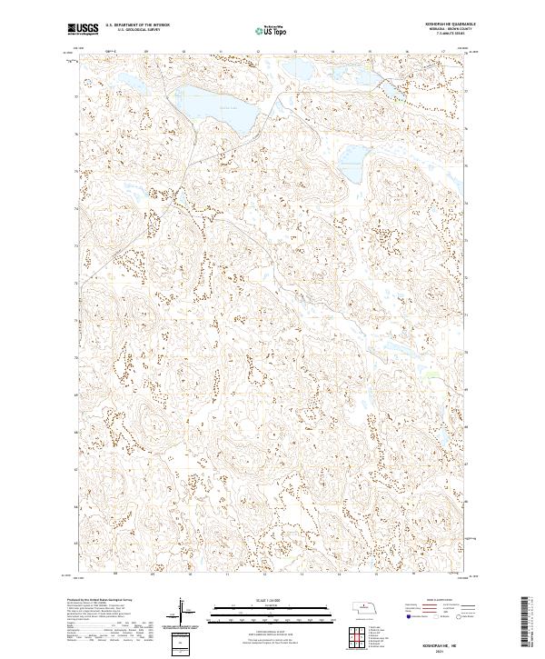
2021 Map of Koshopah NE
USGS Topo · Published 2021About this map
Willow Lake and Diamond Lake serve as the primary focal points in this section of the Nebraska Sandhills, a landscape defined by its distinctive dune formations and terminal wetlands. Located in Brown County, this 2021 survey illustrates the sparsely populated ranching country where Elsmere Rd provides the only significant terrestrial access across the shifting terrain. The hydrography, including the clustered Chain Lakes, reflects the high water table characteristic of this region, which has long supported localized cattle operations. The map details the Public Land Survey System grid across Townships 25 and 26 North, showing how section lines and occasional tracks navigate the natural depressions between the sandy rises.
Find a feature on this map
8 named features on this map. Tap any name to fly to it.
Don’t see what you’re looking for? This feature index may not catch every label — zoom into the map to look around manually.
Map Details
Editions of this 2021 Koshopah NE Map
This is the sole edition of this map. No revisions or reprints were ever made.
Other maps of this area

1949 · Koshopah
USGS Topo · 1:62,500

1951 · Moon Lake
USGS Topo · 1:62,500

1951 · Koshopah
USGS Topo · 1:62,500

1955 · O'Neill
USGS Topo · 1:250,000

1957 · Valentine
USGS Topo · 1:250,000

1959 · Valentine
USGS Topo · 1:250,000

1959 · O'Neill
USGS Topo · 1:250,000

1969 · O'Neill
USGS Topo · 1:250,000
1982 · Goldman Lake NW
USGS Topo · 1:24,000
1982 · Raven SW
USGS Topo · 1:24,000