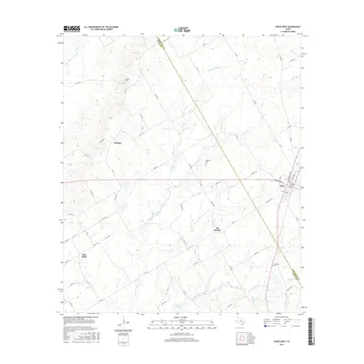
2016 Map of Kosse West
USGS Topo · Published 2016About this map
The boundary between Limestone Co and Falls Co cuts diagonally through this rural Texas landscape, where the town of Kosse sits at the eastern edge. This area is defined by the headwaters of the Little Brazos River and its numerous tributaries, including Sulfur Cr, Tucker Cr, and Polecat Cr. The settlement patterns here remain tied to the road network, with established locales like Alto Springs, Blue Ridge, and Stranger serving as historical markers for local families. Genealogists will find particular value in the documentation of several family and community burial grounds, such as Garrett Cem in the north and Hopewell Cem located near the center of the survey. The terrain is characterized by a series of drainages like Long Br and Mustang Br that feed into the larger river system, shaping the agricultural layout of the county line region.
Find a feature on this map
67 named features on this map. Tap any name to fly to it.
Don’t see what you’re looking for? This feature index may not catch every label — zoom into the map to look around manually.
Map Details
Editions of this 2016 Kosse West Map
This is the sole edition of this map. No revisions or reprints were ever made.
Other maps of this area

1954 · Waco
USGS Topo · 1:250,000

1955 · Waco
USGS Topo · 1:250,000

1957 · Otto
USGS Topo · 1:24,000

1957 · McClanahan
USGS Topo · 1:24,000

1962 · Reagan
USGS Topo · 1:24,000

1962 · Bremond
USGS Topo · 1:24,000

1962 · Petteway
USGS Topo · 1:24,000

1965 · Kosse West
USGS Topo · 1:24,000

1966 · Thornton
USGS Topo · 1:24,000
1966 · Odds
USGS Topo · 1:24,000