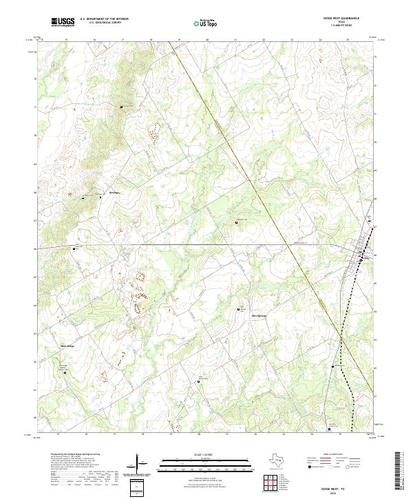
2022 Map of Kosse West
USGS Topo · Published 2022About this map
Stranger and Alto Springs anchor this portion of the Texas landscape, where the boundary between Limestone Co and Falls Co follows the local drainages and country roads. The area is defined by a dense network of cemeteries, such as Stranger Cem and Alto Springs Cem, which provide significant points of interest for genealogical research in these rural communities. The Little Brazos River winds through the center of the sheet, fed by numerous tributaries including Tucker Creek and Sulfur Creek.
Find a feature on this map
75 named features on this map. Tap any name to fly to it.
Don’t see what you’re looking for? This feature index may not catch every label — zoom into the map to look around manually.
Map Details
Editions of this 2022 Kosse West Map
This is the sole edition of this map. No revisions or reprints were ever made.
Other maps of this area

1954 · Waco
USGS Topo · 1:250,000

1955 · Waco
USGS Topo · 1:250,000

1957 · Otto
USGS Topo · 1:24,000

1957 · McClanahan
USGS Topo · 1:24,000

1962 · Reagan
USGS Topo · 1:24,000

1962 · Bremond
USGS Topo · 1:24,000

1962 · Petteway
USGS Topo · 1:24,000

1965 · Kosse West
USGS Topo · 1:24,000

1966 · Thornton
USGS Topo · 1:24,000
1966 · Odds
USGS Topo · 1:24,000