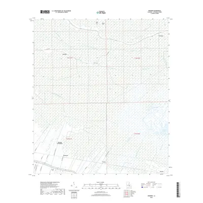
2018 Map of Kraemer
USGS Topo · Published 2018About this map
Melodia Plantation and the surrounding riverine settlements define this stretch of Lafourche Parish, where human habitation clings to the narrow natural levees of Bayou Lafourche. The landscape is dominated by the vast Rathborne Swamp, a dense hydrologic network of winding waterways like Grand Bayou and Bayou Baton Pilon that drain toward Lake Boeuf. Small linear settlements such as Rousseau, Ewing, and Theriot follow the primary roadway and bayou, illustrating the traditional Long Lot land division pattern typical of South Louisiana. To the north, the communities of Choctaw and Kraemer sit on slightly higher ground, separated from the southern hamlets by the Pitre-Lening Canal and several named bayous including Bayou L'Ours and Bayou Jean Webre.
Find a feature on this map
38 named features on this map. Tap any name to fly to it.
Don’t see what you’re looking for? This feature index may not catch every label — zoom into the map to look around manually.
Map Details
Editions of this 2018 Kraemer Map
This is the sole edition of this map. No revisions or reprints were ever made.
Other maps of this area

1892 · Lac Des Allemands
USGS Topo · 1:62,500

1892 · Gibson
USGS Topo · 1:62,500

1892 · Houma
USGS Topo · 1:62,500

1892 · Thibodaux
USGS Topo · 1:62,500

1897 · Gibson
USGS Topo · 1:62,500

1932 · Lac Des Allemands NW
USGS Topo · 1:31,680

1932 · Lac Des Allemands SE
USGS Topo · 1:31,680

1932 · Lac Des Allemands SW
USGS Topo · 1:31,680

1932 · Houma NE
USGS Topo · 1:31,680

1932 · Thibodaux NE
USGS Topo · 1:31,680