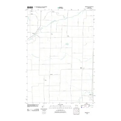
2010 Map of Krakow
USGS Topo · Published 2010About this map
The Oconto River winds through the northern reaches of this Wisconsin landscape, where the rural settlements of Mosling and Pulcifer once served as vital community hubs. This survey captures a pattern of agricultural development defined by a strict grid of county highways and local lanes, connecting small hamlets like Advance and Green Valley. Genealogists will find significant value in the distribution of several community burial grounds, including the Danish Cemetery and Saint Johns Cemetery in the north, and the Dickson Cemetery further south near the North Branch Pensaukee River.
Find a feature on this map
52 named features on this map. Tap any name to fly to it.
Don’t see what you’re looking for? This feature index may not catch every label — zoom into the map to look around manually.
Map Details
Editions of this 2010 Krakow Map
This is the sole edition of this map. No revisions or reprints were ever made.
Other maps of this area

1954 · Green Bay
USGS Topo · 1:62,500

1955 · Seymour
USGS Topo · 1:62,500

1955 · Green Bay
USGS Topo · 1:250,000

1956 · Gillett
USGS Topo · 1:62,500

1956 · Oconto Falls
USGS Topo · 1:62,500

1974 · Cecil
USGS Topo · 1:24,000
1974 · Oconto Falls North
USGS Topo · 1:24,000
1974 · Gillett
USGS Topo · 1:24,000
1974 · Berry Lake
USGS Topo · 1:24,000

1974 · Zachow
USGS Topo · 1:24,000