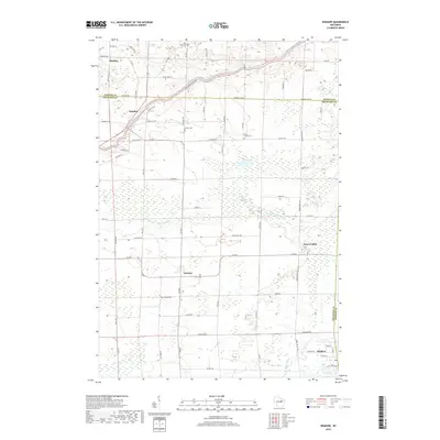
2018 Map of Krakow
USGS Topo · Published 2018About this map
The Oconto River snakes across the northern border of this landscape, marking a topographically varied corridor through the Oconto and Shawano county line. Smaller rural settlements like Mosling, Pulcifer, and Advance are connected by a network of county roads and family-named thoroughfares such as Patzer Ln and Gandt Rd. The map reveals a high density of small-town landmarks essential for local history, specifically cemeteries that serve these farming communities, including Saint Johns Cem and Danish Cem.
Find a feature on this map
68 named features on this map. Tap any name to fly to it.
Don’t see what you’re looking for? This feature index may not catch every label — zoom into the map to look around manually.
Map Details
Editions of this 2018 Krakow Map
This is the sole edition of this map. No revisions or reprints were ever made.
Other maps of this area

1954 · Green Bay
USGS Topo · 1:62,500

1955 · Seymour
USGS Topo · 1:62,500

1955 · Green Bay
USGS Topo · 1:250,000

1956 · Gillett
USGS Topo · 1:62,500

1956 · Oconto Falls
USGS Topo · 1:62,500

1974 · Cecil
USGS Topo · 1:24,000
1974 · Oconto Falls North
USGS Topo · 1:24,000
1974 · Gillett
USGS Topo · 1:24,000
1974 · Berry Lake
USGS Topo · 1:24,000

1974 · Zachow
USGS Topo · 1:24,000