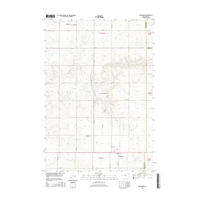
2015 Map of Kranzburg
USGS Topo · Published 2015About this map
The Coteau des Prairies plateau shapes the geography of this Codington County landscape, where the settlements of Waverly and Kranzburg anchor a rural community defined by its township grids and prairie drainage. Small watercourses like Willow Creek and Stray Horse Creek meander through the terrain, illustrating the natural watershed before it meets the developed agricultural roads. For genealogists and local historians, the map is particularly rich in cemetery data, documenting sites such as Saint Joseph's Catholic Cemetery, Holy Rosary Cemetery, and the Schneider's Grove Cemetery. A unique and poignant landmark, the Spooner Children Graves, is noted in the southern portion of the quadrangle near Kranzburg, offering a specific point of interest for those researching early family histories and pioneer settlements in eastern South Dakota.
Find a feature on this map
33 named features on this map. Tap any name to fly to it.
Don’t see what you’re looking for? This feature index may not catch every label — zoom into the map to look around manually.
Map Details
Editions of this 2015 Kranzburg Map
This is the sole edition of this map. No revisions or reprints were ever made.
Other maps of this area

1953 · Milbank
USGS Topo · 1:250,000

1953 · Watertown
USGS Topo · 1:250,000

1958 · Milbank
USGS Topo · 1:250,000

1958 · Watertown
USGS Topo · 1:250,000

1969 · Watertown SE
USGS Topo · 1:24,000

1969 · Watertown East
USGS Topo · 1:24,000

1970 · Kranzburg SW
USGS Topo · 1:24,000

1970 · Kranzburg
USGS Topo · 1:24,000

1970 · Bemis
USGS Topo · 1:24,000

1970 · Goodwin
USGS Topo · 1:24,000