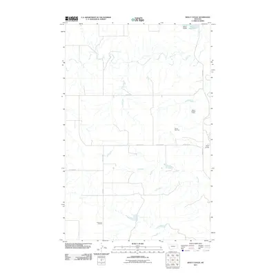
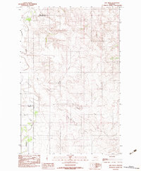
2011 Map of Kraut Coulee
USGS Topo · Published 2011About this map
Prairie Lawn Cemetery serves as a lone quiet landmark in this stretch of McCone County, where the landscape is defined by the ephemeral drainages of the Missouri River plateau. The drainage network is anchored by Wolf Creek and Little Creek, while the namesake Kraut Coulee and Waters Coulee carve through the terrain. Human modification of the arid environment is evident in the water management infrastructure, including Waters Reservoir and several small-scale impoundments such as Waters Number 5 Dam and Brown Bear Dam. The road network, including Redwater Rd and Vida East Rd, follows the section lines of the Public Land Survey System, reflecting the organized ranching and agricultural development of this eastern Montana region.
Find a feature on this map
14 named features on this map. Tap any name to fly to it.
Don’t see what you’re looking for? This feature index may not catch every label — zoom into the map to look around manually.
Map Details
Editions of this 2011 Kraut Coulee Map
This is the sole edition of this map. No revisions or reprints were ever made.
Other maps of this area

1954 · Glendive
USGS Topo · 1:250,000

1957 · Glendive
USGS Topo · 1:250,000

1958 · Glendive
USGS Topo · 1:250,000
1983 · Sullivan Coulee
USGS Topo · 1:24,000

1983 · Buffalo Creek NE
USGS Topo · 1:24,000
1983 · Gady Coulee
USGS Topo · 1:24,000
1983 · Kraut Coulee
USGS Topo · 1:24,000

1983 · Beery Reservoir
USGS Topo · 1:24,000

1983 · Richey NW
USGS Topo · 1:24,000
1983 · Lisk Creek
USGS Topo · 1:24,000