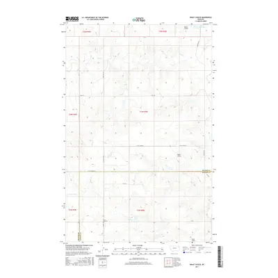
2017 Map of Kraut Coulee
USGS Topo · Published 2017About this map
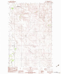
Prairie Lawn Cem stands as a quiet landmark in this 2017 survey of the high plains along the McCone and Dawson County border. The landscape is defined by the complex drainage systems of Kraut Coulee and Waters Coulee, which channel seasonal runoff toward Wolf Cr and Little Cr. This rural stretch of eastern Montana is organized by a sparse but essential grid of section roads, including Little Creek Rd, Redwater Rd, and Gold Gulch Rd, which facilitate access across the undulating terrain. Small-scale water management is evident at Waters Reservoir in the northeast, providing a rare permanent water source in this dry environment. The mapping reflects a region where land use is dictated by the deeply incised draws like Gold Gulch, and where the Public Land Survey System remains the primary framework for navigation and property.
Find a feature on this map
22 named features on this map. Tap any name to fly to it.
Don’t see what you’re looking for? This feature index may not catch every label — zoom into the map to look around manually.
Map Details
Editions of this 2017 Kraut Coulee Map
This is the sole edition of this map. No revisions or reprints were ever made.
Other maps of this area

1954 · Glendive
USGS Topo · 1:250,000

1957 · Glendive
USGS Topo · 1:250,000

1958 · Glendive
USGS Topo · 1:250,000
1983 · Sullivan Coulee
USGS Topo · 1:24,000

1983 · Buffalo Creek NE
USGS Topo · 1:24,000
1983 · Gady Coulee
USGS Topo · 1:24,000
1983 · Kraut Coulee
USGS Topo · 1:24,000

1983 · Beery Reservoir
USGS Topo · 1:24,000

1983 · Richey NW
USGS Topo · 1:24,000
1983 · Lisk Creek
USGS Topo · 1:24,000