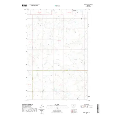
2020 Map of Kraut Coulee
USGS Topo · Published 2020About this map
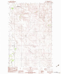
Prairie Lawn Cem stands as a quiet focal point in this high-plains landscape near the border of McCone and Dawson counties. This 2020 survey illustrates the remote character of eastern Montana, where the terrain is carved by seasonal drainages such as Waters Coulee and Kraut Coulee. These coulees, along with Wolf Cr and Little Cr, define the watershed of the region, feeding into small catchments like Waters Reservoir. The map reveals a systematic grid of section lines and gravel roads, including Redwater Rd and Vida East Rd, which navigate the rises and falls of the prairie. In the southern reaches, Gold Gulch provides a further example of the deep erosional features typical of the local topography, highlighting the sparsely populated but extensively managed ranching or agricultural tracts of the Missouri Plateau.
Find a feature on this map
22 named features on this map. Tap any name to fly to it.
Don’t see what you’re looking for? This feature index may not catch every label — zoom into the map to look around manually.
Map Details
Editions of this 2020 Kraut Coulee Map
This is the sole edition of this map. No revisions or reprints were ever made.
Other maps of this area

1954 · Glendive
USGS Topo · 1:250,000

1957 · Glendive
USGS Topo · 1:250,000

1958 · Glendive
USGS Topo · 1:250,000
1983 · Sullivan Coulee
USGS Topo · 1:24,000

1983 · Buffalo Creek NE
USGS Topo · 1:24,000
1983 · Gady Coulee
USGS Topo · 1:24,000
1983 · Kraut Coulee
USGS Topo · 1:24,000

1983 · Beery Reservoir
USGS Topo · 1:24,000

1983 · Richey NW
USGS Topo · 1:24,000
1983 · Lisk Creek
USGS Topo · 1:24,000