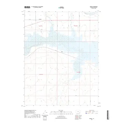
2019 Map of Kreybill
USGS Topo · Published 2019About this map
The John Martin Reservoir dominates the central landscape of this Bent County region, where the Arkansas River valley is defined by an intricate network of irrigation infrastructure. Water management is the primary driver of settlement here, with the Fort Lyon Canal, Kicking Bird Canal, and Miller Ditch distributing vital resources to the surrounding plains. The small settlements of Kreybill and Hilton are situated along the northern and southern edges of the reservoir's basin, serving as focal points for the rural road network including Co RD FF 5 and Co RD 19. Natural drainages such as Gageby Cr, McRae Arroyo, and Rule Cr feed into the massive impoundment, illustrating the complex hydrology required for agriculture in this high-plains environment. This map details the intersection of modern civil engineering and the seasonal water cycles of the Colorado prairie.
Find a feature on this map
28 named features on this map. Tap any name to fly to it.
Don’t see what you’re looking for? This feature index may not catch every label — zoom into the map to look around manually.
Map Details
Editions of this 2019 Kreybill Map
This is the sole edition of this map. No revisions or reprints were ever made.
Other maps of this area

1891 · Higbee
USGS Topo · 1:125,000

1891 · Las Animas
USGS Topo · 1:125,000

1892 · Lamar
USGS Topo · 1:125,000

1892 · Two Butte
USGS Topo · 1:125,000

1893 · Higbee
USGS Topo · 1:125,000

1893 · Two Butte
USGS Topo · 1:125,000

1893 · Las Animas
USGS Topo · 1:125,000

1953 · Hasty
USGS Topo · 1:24,000

1953 · Las Animas
USGS Topo · 1:24,000

1953 · Kreybill
USGS Topo · 1:24,000