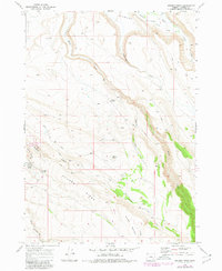
1968 Map of Krumbo Ridge
USGS Topo · Published 1980About this map
Malheur National Wildlife Refuge boundaries delineate this portion of Harney County, where the high desert terrain transitions into a complex system of drainage and springs. The landscape is defined by the prominent Krumbo Ridge and the nearby elevation of Krumbo Butte, which overlook a network of seasonal and perennial water sources. Critical water points like Ruby Springs, Krumbo Springs, and Hidden Seep are meticulously mapped, illustrating the vital role of water management in this arid region.
Find a feature on this map
18 named features on this map. Tap any name to fly to it.
Don’t see what you’re looking for? This feature index may not catch every label — zoom into the map to look around manually.
Map Details
Editions of this 1968 Krumbo Ridge Map
2 editions found
Other maps of this area

1955 · Burns
USGS Topo · 1:250,000

1955 · Adel
USGS Topo · 1:250,000

1957 · Adel
USGS Topo · 1:250,000

1958 · Burns
USGS Topo · 1:250,000

1958 · Adel
USGS Topo · 1:250,000

1959 · Burns
USGS Topo · 1:250,000

1962 · Adel
USGS Topo · 1:250,000

1967 · Happy Valley
USGS Topo · 1:24,000

1967 · Krumbo Reservoir
USGS Topo · 1:24,000
1967 · Diamond Swamp
USGS Topo · 1:24,000