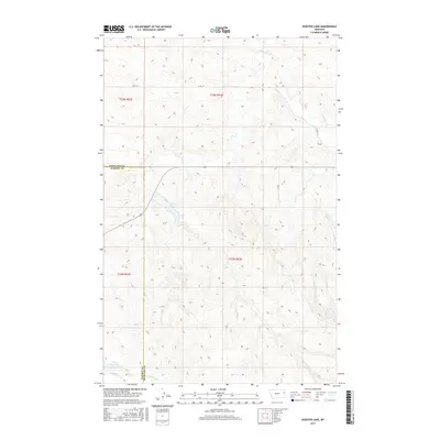
2017 Map of Kuester Lake
USGS Topo · Published 2017About this map
Kuester Lake and the undulating terrain of eastern Montana define this landscape, where the borders of Richland and Dawson counties intersect. This 2017 study reveals a sparsely settled region primarily shaped by intermittent water systems like E Redwater Cr and the S Fork Lisk Cr. The presence of Wold Reservoir in the southwestern corner highlights the importance of water management in this high plains environment.
Find a feature on this map
12 named features on this map. Tap any name to fly to it.
Don’t see what you’re looking for? This feature index may not catch every label — zoom into the map to look around manually.
Map Details
Editions of this 2017 Kuester Lake Map
This is the sole edition of this map. No revisions or reprints were ever made.
Other maps of this area

1909 · Glendive
USGS Topo · 1:250,000

1954 · Glendive
USGS Topo · 1:250,000

1957 · Glendive
USGS Topo · 1:250,000

1958 · Glendive
USGS Topo · 1:250,000

1972 · Clay Butte
USGS Topo · 1:24,000

1972 · Enid SE
USGS Topo · 1:24,000

1972 · Kuester Lake
USGS Topo · 1:24,000

1972 · Enid
USGS Topo · 1:24,000

1981 · Sidney
USGS Topo · 1:100,000
1983 · Carda Coulee
USGS Topo · 1:24,000