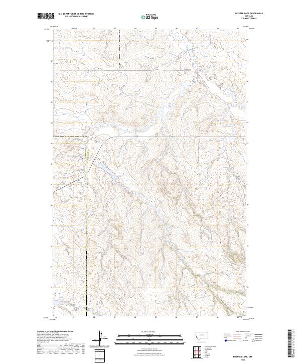
2024 Map of Kuester Lake
USGS Topo · Published 2024About this map
East Redwater Creek and its various tributaries carve through this undulating landscape along the boundary of Dawson and Richland Counties. The terrain is defined by the South Fork of the South Fork Lisk Creek at the southern edge, while the interior is punctuated by Wold Reservoir. This 2024 survey illustrates a largely open, rural ranching or agricultural environment, where the human footprint is primarily limited to section lines and local connectors like Co Rd 126 and Co 315. The drainage patterns suggest a complex topography of coulees and ridges that have historically influenced the movement of livestock and the placement of water management features in this part of Montana.
Find a feature on this map
10 named features on this map. Tap any name to fly to it.
Don’t see what you’re looking for? This feature index may not catch every label — zoom into the map to look around manually.
Map Details
Editions of this 2024 Kuester Lake Map
This is the sole edition of this map. No revisions or reprints were ever made.
Other maps of this area

1909 · Glendive
USGS Topo · 1:250,000

1954 · Glendive
USGS Topo · 1:250,000

1957 · Glendive
USGS Topo · 1:250,000

1958 · Glendive
USGS Topo · 1:250,000

1972 · Clay Butte
USGS Topo · 1:24,000

1972 · Enid SE
USGS Topo · 1:24,000

1972 · Kuester Lake
USGS Topo · 1:24,000

1972 · Enid
USGS Topo · 1:24,000

1981 · Sidney
USGS Topo · 1:100,000
1983 · Carda Coulee
USGS Topo · 1:24,000