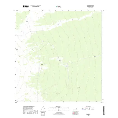
2017 Map of Kulani
USGS Topo · Published 2017About this map
Volcanic activity has fundamentally shaped the landscape of the Island of Hawai‘i shown here, where the distinct paths of the Lava Flow of 1852 and the Lava Flow of 1942 cut across the high-elevation terrain. This 2017 survey documents the relationship between these historic geological events and the modern transportation corridor of Stainback Hwy, which provides access to the interior heights. Cultural and geographical landmarks such as Kūlani, Pu‘ukipū, and Pu‘ulala‘au dot the slopes, while isolated features like Solomons Waterhole and the volcanic pits of Na Lua Mahoe provide specific points of reference for researchers and local historians studying the island's natural progression and human utility of the land.
Find a feature on this map
10 named features on this map. Tap any name to fly to it.
Don’t see what you’re looking for? This feature index may not catch every label — zoom into the map to look around manually.
Map Details
Editions of this 2017 Kulani Map
This is the sole edition of this map. No revisions or reprints were ever made.
Other maps of this area

1917 · Hilo
USGS Topo · 1:62,500

1921 · Kilauea
USGS Topo · 1:62,500

1922 · Puna
USGS Topo · 1:62,500

1924 · Kilauea
USGS Topo · 1:62,500

1924 · Puna
USGS Topo · 1:62,500

1930 · Humuula
USGS Topo · 1:62,500

1932 · Hilo
USGS Topo · 1:62,500

1954 · Hawaii South
USGS Topo · 1:250,000

1954 · Hawaii North
USGS Topo · 1:250,000

1956 · Puu Oo
USGS Topo · 1:24,000