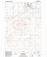
1992 Map of Kuna
USGS Topo · Published 1992About this map
The town of Kuna serves as the focal point of this agricultural and desert landscape, characterized by an intricate network of irrigation infrastructure and volcanic topography. Water management is central to the area's development, with the New York Canal, Kuna Canal, and Mora Canal redirecting the flow of Indian Creek to support local farming. South of the main settlement, the land rises toward Kuna Butte before dropping toward the Snake River canyon. This southern portion of the map is dominated by the Birds Of Prey Area, a significant conservation landscape. Local history is reflected in the presence of Ross Sch and Hubbard Sch, alongside the Cem and the unique geological landmark of Kuna Cave. The survey captures the Boise Meridian's role in the regional grid, separating Canyon and Ada counties.
Find a feature on this map
62 named features on this map. Tap any name to fly to it.
Don’t see what you’re looking for? This feature index may not catch every label — zoom into the map to look around manually.
Map Details
Editions of this 1992 Kuna Map
This is the sole edition of this map. No revisions or reprints were ever made.
Other maps of this area

1892 · Boise
USGS Topo · 1:125,000

1892 · Bisuka
USGS Topo · 1:125,000

1892 · Silver City
USGS Topo · 1:125,000

1894 · Bisuka
USGS Topo · 1:125,000

1894 · Silver City
USGS Topo · 1:125,000

1897 · Boise
USGS Topo · 1:125,000

1898 · Nampa
USGS Topo · 1:125,000

1898 · Silver City
USGS Topo · 1:125,000

1953 · Cloverdale
USGS Topo · 1:24,000

1953 · Meridian
USGS Topo · 1:24,000