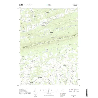
2019 Map of Kunkletown
USGS Topo · Published 2019About this map
Chestnut Ridge dominates the northern portion of this landscape, creating a natural barrier that separates the valley of Buckwha Creek from the southern drainages. The Appalachian National Scenic Trail traverses the high ground of the ridge, passing south of Kunkletown and Smith Gap. This area reflects a long-established rural settlement pattern where small villages like Point Phillip, Klecknersville, and Emanuelsville are situated at key road intersections. Local history is anchored by sites such as the Saint Matthews United Church of Christ Cem and Saint Matthews Union Cem in the north, and Fairview Cem near Chapman in the southeast. Numerous waterways, including Hokendauqua Creek and Monocacy Cr, define the topography as they flow toward the Lehigh Valley, supporting small residential clusters and agricultural tracts.
Find a feature on this map
181 named features on this map. Tap any name to fly to it.
Don’t see what you’re looking for? This feature index may not catch every label — zoom into the map to look around manually.
Map Details
Editions of this 2019 Kunkletown Map
This is the sole edition of this map. No revisions or reprints were ever made.
Other maps of this area

1894 · Allentown
USGS Topo · 1:62,500

1902 · Slatington
USGS Topo · 1:62,500

1914 · Wind Gap
USGS Topo · 1:62,500

1916 · Wind Gap
USGS Topo · 1:62,500

1922 · Mauch Chunk
USGS Topo · 1:62,500

1924 · Mauch Chunk
USGS Topo · 1:62,500

1937 · Allentown West
USGS Topo · 1:48,000

1939 · Allentown
USGS Topo · 1:62,500

1942 · Allentown West
USGS Topo · 1:62,500

1943 · Mauch Chunk
USGS Topo · 1:62,500
Featured Places
- Chapman, Moore Township
- Klecknersville, Moore Township
- Delps, Moore Township
- Rockville, Lehigh Township
- Point Phillip, Moore Township