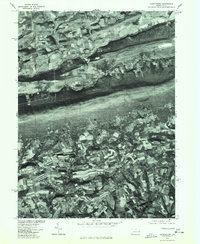
1976 Map of Kunkletown
USGS Topo · Published 1978About this map
The northern reaches of Northampton County are captured here through orthophotography, revealing the sharp contrast between the dense woodlands of the ridgelines and the intricate patchwork of agriculture in the valleys below. The community of Kunkletown sits at the base of a significant mountain slope, serving as a focal point for the rural landscape in the late 1970s. This aerial perspective, produced in cooperation with the Soil Conservation Service, provides a clear view of the field boundaries and woodland margins surrounding Point Phillip and Rockville. To the south, the settlement patterns of Chapman and Petersville show the steady integration of small villages into the surrounding farmland. The map's photographic nature allows for an exact study of 1970s land use, capturing the specific texture of the Pennsylvania countryside before later development altered these rural corridors.
Find a feature on this map
5 named features on this map. Tap any name to fly to it.
Don’t see what you’re looking for? This feature index may not catch every label — zoom into the map to look around manually.
Map Details
Editions of this 1976 Kunkletown Map
This is the sole edition of this map. No revisions or reprints were ever made.
Other maps of this area

1894 · Allentown
USGS Topo · 1:62,500

1902 · Slatington
USGS Topo · 1:62,500

1914 · Wind Gap
USGS Topo · 1:62,500

1916 · Wind Gap
USGS Topo · 1:62,500

1922 · Mauch Chunk
USGS Topo · 1:62,500

1924 · Mauch Chunk
USGS Topo · 1:62,500

1937 · Allentown West
USGS Topo · 1:48,000

1939 · Allentown
USGS Topo · 1:62,500

1942 · Allentown West
USGS Topo · 1:62,500

1943 · Mauch Chunk
USGS Topo · 1:62,500
Featured Places
- Chapman, Moore Township
- Eldred Township, PA
- Lehigh Township, PA
- Crossroads, Moore Township
- Moore Township, PA