
1917 Map of Kurand
USGS Topo · Published 1917About this map
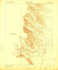
Kurand stands as a primary settlement point at the junction of the hills and the valley floor in this 1917 survey of Glenn County. The landscape is defined by the transition from the alluvial plains of the Sacramento Valley to the foothills of the Coast Range, carved by seasonal watercourses like Nye Creek and Willow Creek. A significant piece of industrial history is recorded here in the form of the Southern Pacific railroad, specifically the Fruto Branch, which served the region's agricultural and ranching needs. The map captures the intricate drainage patterns of the western foothills, including the long, north-south oriented Stone Valley and the steep terrain surrounding Salt Gulch and Hayes Hollow. These landforms provided natural corridors for early development and ranching boundaries during the early twentieth century.
Find a feature on this map
13 named features on this map. Tap any name to fly to it.
Don’t see what you’re looking for? This feature index may not catch every label — zoom into the map to look around manually.
Map Details
Editions of this 1917 Kurand Map
3 editions found
Other maps of this area

1904 · Walker Creek
USGS Topo · 1:31,680

1904 · Logan Creek
USGS Topo · 1:24,000

1906 · Maxwell
USGS Topo · 1:62,500

1906 · Willows
USGS Topo · 1:62,500

1914 · Orland
USGS Topo · 1:31,680

1917 · Lyman
USGS Topo · 1:31,680

1917 · Logandale
USGS Topo · 1:31,680

1918 · Logan Creek
USGS Topo · 1:31,680

1919 · Fruto
USGS Topo · 1:62,500

1943 · Lodoga
USGS Topo · 1:62,500