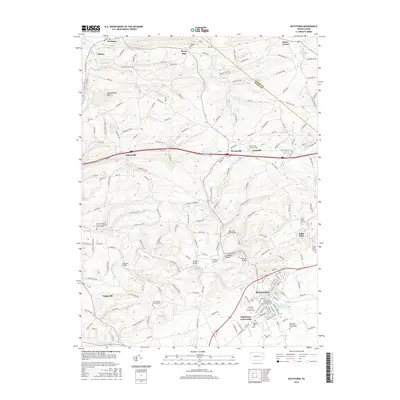
2016 Map of Kutztown
USGS Topo · Published 2016About this map
Kutztown serves as the academic and cultural anchor of this Berks County landscape, dominated by the expansive campus of Kutztown University. The surrounding rural townships are defined by a network of historic river crossings and family landmarks, including several notable spans such as Dietrichs Mill Bridge, Sacony Bridge, and Heffners Bridge. These structures illustrate the importance of the local creek systems, like Sacony Creek and Maiden Creek, in shaping the region's movement and early industrial sites.
Find a feature on this map
182 named features on this map. Tap any name to fly to it.
Don’t see what you’re looking for? This feature index may not catch every label — zoom into the map to look around manually.
Map Details
Editions of this 2016 Kutztown Map
This is the sole edition of this map. No revisions or reprints were ever made.
Other maps of this area

1894 · Reading
USGS Topo · 1:62,500

1902 · Boyertown
USGS Topo · 1:62,500

1902 · Slatington
USGS Topo · 1:62,500

1909 · Hamburg
USGS Topo · 1:62,500

1911 · Hamburg
USGS Topo · 1:62,500

1913 · Reading
USGS Topo · 1:62,500

1915 · Reading
USGS Topo · 1:62,500
1937 · Allentown West
USGS Topo · 1:48,000
1942 · Allentown West
USGS Topo · 1:62,500
1943 · Manatawny
USGS Topo · 1:31,680