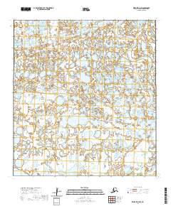
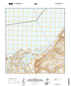
2020 Map of Kwiguk D-3 NW
USGS Topo · Published 2020About this map
The Pastolik River meanders across this northern Alaskan landscape within the Kusilvak Census Area, reflecting the complex aquatic geography of the Yukon-Kuskokwim Delta. This region is characterized by a dense network of wetlands and tidal influences, where the Chantili Slough serves as a critical waterway connecting various parts of the delta's intricate hydrological system. The map reveals a terrain defined by shifting water levels and historical land divisions, including townships such as t34n r74w and t33n r75w, illustrating how the Public Land Survey System imposes a grid upon a fluid, ever-changing subarctic environment.
Find a feature on this map
8 named features on this map. Tap any name to fly to it.
Don’t see what you’re looking for? This feature index may not catch every label — zoom into the map to look around manually.
Map Details
Editions of this 2020 Kwiguk D-3 NW Map
This is the sole edition of this map. No revisions or reprints were ever made.
Other maps of this area

1951 · St Michael
USGS Topo · 1:250,000

1952 · Kwiguk
USGS Topo · 1:250,000
1952 · Saint Michael A-4
USGS Topo · 1:63,360

1952 · Kwiguk D-3
USGS Topo · 1:63,360
1952 · Saint Michael A-3
USGS Topo · 1:63,360

1952 · Kwiguk D-4
USGS Topo · 1:63,360

1952 · St Michael
USGS Topo · 1:250,000

1964 · St. Michael
USGS Topo · 1:250,000
2020 · Kwiguk D-4 NE
USGS Topo · 1:25,000
2020 · Saint Michael A-3 SE
USGS Topo · 1:25,000