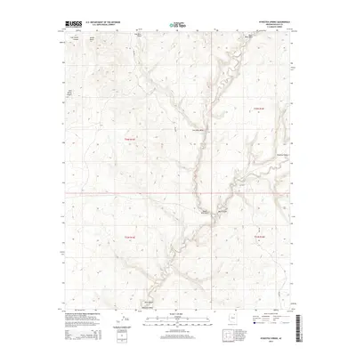
2014 Map of Kydestea Spring
USGS Topo · Published 2014About this map
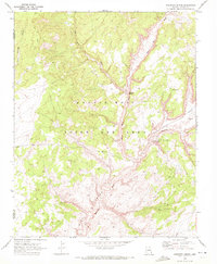
Kydestea Spring and Cottonwood Spring punctuate the arid landscape of Navajo County, providing critical water sources in a region defined by deeply cut drainage systems. This 2014 survey documents the convergence of several major washes, most notably the Coal Mine Wash and Black Mesa Wash, which join to form the striking geological features of Blue Canyon. The terrain is characterized by high-elevation landforms such as Yellow Butte and the carved descent of Coal Spring Canyon. While the area remains largely undeveloped, the presence of Bia-6620 and other primitive routes suggests the ongoing importance of access across these tribal lands. The map also traces the northern reaches of the Moenkopi Wash, illustrating the complex hydrological network that shapes this portion of the Arizona desert.
Find a feature on this map
13 named features on this map. Tap any name to fly to it.
Don’t see what you’re looking for? This feature index may not catch every label — zoom into the map to look around manually.
Map Details
Editions of this 2014 Kydestea Spring Map
This is the sole edition of this map. No revisions or reprints were ever made.
Other maps of this area

1883 · Marsh Pass
USGS Topo · 1:250,000

1892 · Marsh Pass
USGS Topo · 1:250,000

1956 · Marble Canyon
USGS Topo · 1:250,000

1959 · Marble Canyon
USGS Topo · 1:250,000

1961 · Marble Canyon
USGS Topo · 1:250,000
1967 · Rocky Ridge NW
USGS Topo · 1:24,000
1967 · Pillars of Hercules
USGS Topo · 1:24,000
1967 · Rocky Ridge NE
USGS Topo · 1:24,000

1970 · Cow Springs
USGS Topo · 1:24,000
1970 · Kydestea Spring
USGS Topo · 1:24,000