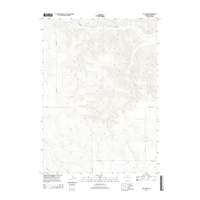
2014 Map of Kyle Creek
USGS Topo · Published 2014About this map
White River winds through the northern portion of this Nebraska High Plains landscape, serving as the primary drainage for a network of deeply etched seasonal watercourses. The drainage pattern is defined by several prominent creeks including Kyle Cr, Hile Cr, and Soldier Spring Cr, which carve through the terrain and dictate the local topography. This early 21st-century survey reflects the enduring rural character of Sioux County, where human presence is marked primarily by a sparse grid of section-line roads and named ranching routes. Navigational arteries like White River Rd and Buckley Rd trace the contours of the land, providing access across this open country. Other notable water features like Tucker Cr and Barngrover Cr further define the intricate watershed, offering a detailed look at the hydrology of the Whistle Creek Precinct region.
Find a feature on this map
12 named features on this map. Tap any name to fly to it.
Don’t see what you’re looking for? This feature index may not catch every label — zoom into the map to look around manually.
Map Details
Editions of this 2014 Kyle Creek Map
This is the sole edition of this map. No revisions or reprints were ever made.
Other maps of this area

1899 · Whistle Creek
USGS Topo · 1:125,000

1955 · Alliance
USGS Topo · 1:250,000

1957 · Alliance
USGS Topo · 1:250,000

1958 · Alliance
USGS Topo · 1:250,000

1979 · Harrison SE
USGS Topo · 1:24,000

1979 · Agate
USGS Topo · 1:24,000

1979 · Harrison East
USGS Topo · 1:24,000

1980 · Kyle Creek
USGS Topo · 1:24,000

1980 · Smiley Canyon
USGS Topo · 1:24,000

1980 · Andrews
USGS Topo · 1:24,000