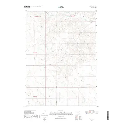
2017 Map of Kyle Creek
USGS Topo · Published 2017About this map
The White River winds through the northern portion of this Sioux County landscape, carving a valley fed by numerous seasonal drainages like Soldier Spring Cr and Tucker Cr. This 2017 survey shows a region defined by its hydrology and sparse rural infrastructure, where the terrain is dissected by prominent waterways including Kyle Cr and Hile Cr. The map reveals a network of section roads that provide access across the township and range boundaries, specifically along White River Rd and Buckley Rd. To the south, Barngrover Cr marks the lower reaches of the quadrangle near W Belmont Rd. The distribution of these named creeks and the winding paths of roads like Andrews Rd illustrate the traditional land use patterns in this part of the Nebraska panhandle, where topography dictates the placement of transit routes and property access.
Find a feature on this map
18 named features on this map. Tap any name to fly to it.
Don’t see what you’re looking for? This feature index may not catch every label — zoom into the map to look around manually.
Map Details
Editions of this 2017 Kyle Creek Map
This is the sole edition of this map. No revisions or reprints were ever made.
Other maps of this area

1899 · Whistle Creek
USGS Topo · 1:125,000

1955 · Alliance
USGS Topo · 1:250,000

1957 · Alliance
USGS Topo · 1:250,000

1958 · Alliance
USGS Topo · 1:250,000

1979 · Harrison SE
USGS Topo · 1:24,000

1979 · Agate
USGS Topo · 1:24,000

1979 · Harrison East
USGS Topo · 1:24,000

1980 · Kyle Creek
USGS Topo · 1:24,000

1980 · Smiley Canyon
USGS Topo · 1:24,000

1980 · Andrews
USGS Topo · 1:24,000