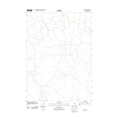
2012 Map of Kyle NE
USGS Topo · Published 2012About this map
Redwater Cr and its various tributaries define the drainage of this South Dakota landscape, where the Big Foot Trl traverses the northeast corner. This 2012 survey by the U.S. Geological Survey documents a network of rural routes, including Bia Rd and Bia Rd 39, which facilitate travel through the northern section of the Pine Ridge Reservation area. In the southwest, No Flesh Cr winds through the terrain, illustrating the sparse but vital water resources that have historically influenced land use and movement in this part of Oglala Lakota County. The map provides a clear look at the contemporary infrastructure, showing the alignment of local roads like Cs 41A against the natural contours of the plains.
Find a feature on this map
7 named features on this map. Tap any name to fly to it.
Don’t see what you’re looking for? This feature index may not catch every label — zoom into the map to look around manually.
Map Details
Editions of this 2012 Kyle NE Map
This is the sole edition of this map. No revisions or reprints were ever made.
Other maps of this area

1950 · Conata SW
USGS Topo · 1:24,000

1950 · Potato Creek
USGS Topo · 1:24,000

1952 · Conata SE
USGS Topo · 1:24,000

1955 · Hot Springs
USGS Topo · 1:250,000

1955 · Martin
USGS Topo · 1:250,000

1958 · Martin
USGS Topo · 1:250,000

1980 · Kadoka
USGS Topo · 1:100,000

1981 · Wall
USGS Topo · 1:100,000

1981 · Yellow Bear Camp
USGS Topo · 1:25,000

1981 · Allen
USGS Topo · 1:25,000